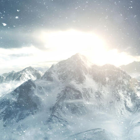
WORLD MAP
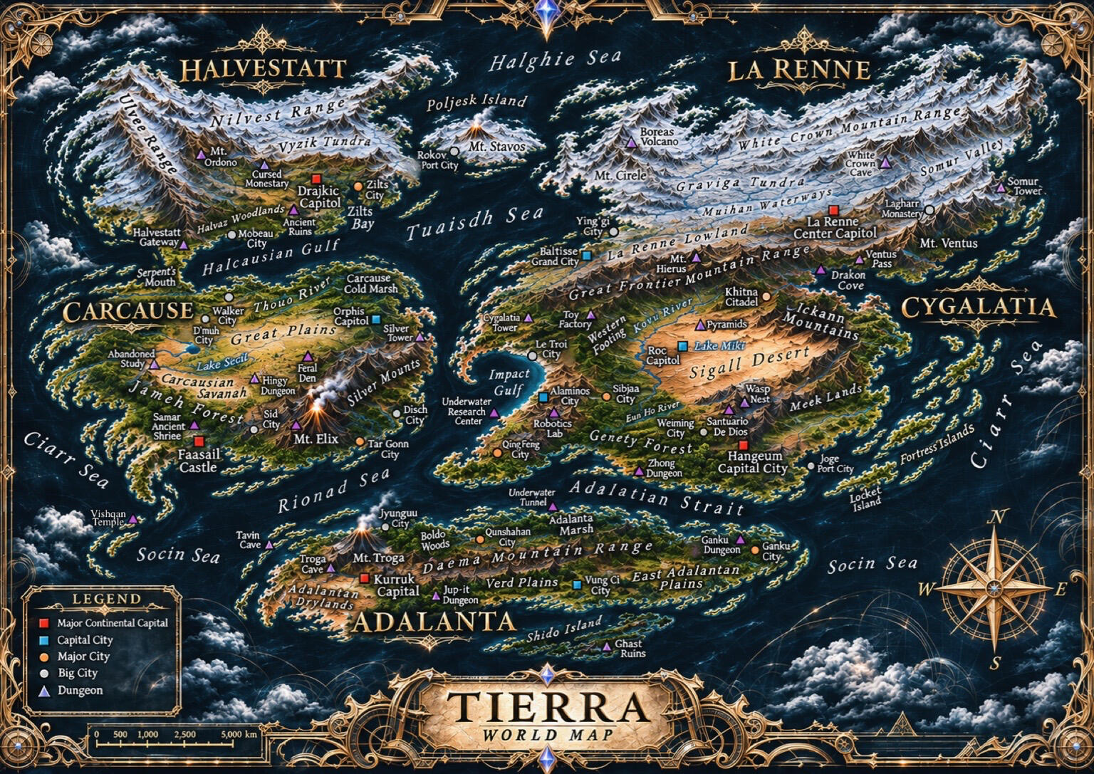
⚠️ This is an AI-generated image.
Idea, drawing, layout, locations are all done by me.
Only THIS image is AI-generated. All other images used in this site are taken from video games.
ADALANTA
An elongated island strip with a long mountain range cutting the through the middle of the island that separates it intro three distinct climates: tropical in the north, wet subtropical in the southeast, and dry subtropical in the southwest. It is surrounded by the Rionad Sea and Adalatian Strait in the northern coast, while the southern coast faces the vast and empty Socin Sea.The continent's mountain range is also a hotspot for having a chain of volcanoes. Its largest volcano is also its most active, and is also the most active volcano on Tierra. Mt. Troga stands proud at the western portion of the island continent and erupts at least once every year. The Adalantan Monorail (AMR) actively avoids the volcanic west, with its westernmost terminal station located at the Kurruk Capital, and goes around the western volcanoes by passing the major coastal cities before going through the Daema to reach the Vung before terminating in the easternmost city.North Adalanta is the tropical region of the continent, attracting many tourists every year to its beaches. The region also boasts itself as being the most biodiverse region on Tierra. Its plains are sandwiched by the Boldo Woods to the west and the Adalanta Marsh to the east, with the Daema Mountain Range separating it from the southern regions.Southwest Adalanta is the driest region, with the heat coming from Mt. Troga, combined with minimal rainfall, creating the condition to sustain the Adalanta Drylands that open up to the Socin Sea in the south. However, the fertile land surrounding the volcano creates suitable liveable conditions to sustain the continent's capital.Southeast Adalanta is the continent's agricultural center, with the Verd Plains and East Adalantan Plains providing vast fertile, arable land for the region. With the Daema Mountain Range stopping in the mideast, the region opens up its coastline to trade and tourism from the Adalatian Strait, Ciarr, and Socin Seas. A cluster of temperate islands governed by Shido is found south of mainland Adalanta and is considered Tierra's southernmost land space.
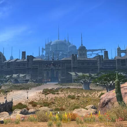
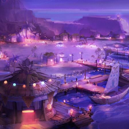
The two main polities of Adalanta are the Kurruk Nation, governing North and Southwest Adalanta, and the Vung governing the land in Southeast Adalanta from the Jup-it Forest in the west all the way to the East Adalantan Plains.The rest of the land, the eastern gulf, is governed by the Gyeuos Kingdom, having the gulf as part of their territory with Ganku City as the main city of the area. Thus, the Vung shares a border with the Gyeuos Kingdom on Southeast Adalanta. Shido Island, with its main governing seat in Shido City, is the main seat of power in the southern islands, however is also dependent on the Vung for economic support. The continental capital is the Kurruk Capital (seen in the photo above), the central seat of power of the Kurruk Nation. Below are the scope of each polity in Adalanta:KURRUK NATION
Capital : Kurruk Capital
Metropolitan/s : Qunshahan City
Major Polity/ies : Jyunguu City (seen in the photo below)
Towns & Municipalities : Mulivoh District, Okaren Town, Tavin Town
Important Locations : Golden Lagoon (Adalanta Marsh), Jyunguu Beach (Jyunguu), Qunshahan Beach (Qunshahan), Skeletar Temple Ruins (Adalantan Drylands), West Daema Mines (Daema Mountain Range)
Dungeons : Tavin Cave, Troga Cave, Underwater TunnelVUNG
Capital : Vung Ci City
Towns & Municipalities : Koppa Town, Ginsu Town, M'hine Town
Important Locations : Archer's Village (Vung Ci), Vung Eastern Farmlands (East Adalantan Plains), Vung Western Farmlands (Verd Plains)
Dungeons : Jup-it DungeonSHIDO ISLAND
Major Polity/ies : Shido City
Towns & Municipalities : Bereva Town, Golddusk Town, Hidema Town
Important Locations : Shido Beach (Shido), Southern Cemetery
Dungeons : Ghast Ruins, Highway to Hell (Ghast Ruins), Shido JungleGYEUOS KINGDOM
Metropolitan/s : Ganku City
Towns & Municipalities : Mako Town
Important Locations : Ikune Temple (Ganku), Ninja Sanctuary (Ganku)
Dungeons : Ganku Dungeon< M E N U >
CARCAUSE
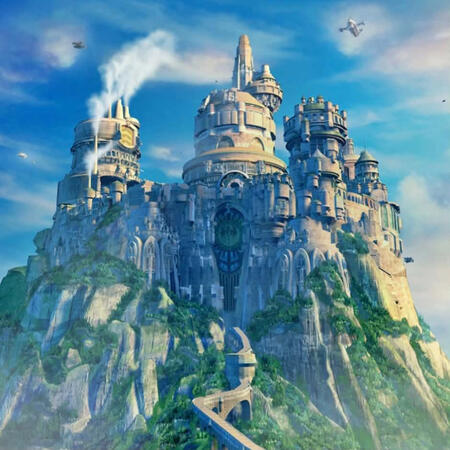
Carcause is the flattest region of Tierra, featuring vast lowland plains and only one short mountain range with a major volcano that fades into small plateaus and narrow uplands. It also houses the biggest rainforest in Tierra, the Jameh Forest. Lake Secil, the largest lake in Tierra, is also found here, sitting as a reservoir basin for smaller river systems that come and go within the Great Plains, as well as water systems from the Jameh Forest and the Silver Mounts.Despite its relatively dryer interior with the Inner Great Plains and the Carcausian Savannah, Carcause has a rather wet east to south coastline due to it being along the storm belt that travels southwest along the Rionad Sea. The colder northwest is also pretty wet as the Tuaisdh Sea brews storms here that travels northeast. This gives the continent land suitable for plant life to flourish and agriculture to be important for the socioeconomic landscape of the polities living there.West Carcause is the huge section of land facing the Ciarr Sea to the west and the Socin Sea to the south. The territorial borders of the region is defined by how much land is covered by the Jameh Forest, a very biodiverse region that stretches from tropical rainforest in the south to a subtropical and temperate forest going to the northwest. The Jameh's southwest, however, is relatively dryer compared to the wet rainforest near the western edges of the Silver Mounts. The Jameh then thins out as it reaches the north and stops at the Serpent's Mouth, which is the only land entryway into Halvestatt. The IRC also terminates at the Serpent's Mouth, pushing commuters to take smaller commute options (such as boats) or walk in order to cross to Halvestatt.Southeast Carcause is the wet tropics of the continent, bordered by the Silver Mounts that separate it from the north and center, and giving a narrow stretch of land that connects it with the southwest. Mt. Elix is an active volcano near the western edge of the Silver Mounts, and its presence in the area provides mineral-rich soil and fresh water that empties into the Jameh Forest and the lowland surrounding it. The coastal settlements along the southeast also benefit greatly, taking advantage of their geographical location for self-sufficiency and global trade.
Central Carcause is considered as the continent's heart with a large flatland stretching from the Carcausian Savannah to the Great Plains (seen in the photo below). Its largely untouched wilderness in the flatlands allows for wildlife to live in peace and flourish within a natural ecosystem. Land in the Great Plains is also used for farming, so the northern part of the region is considered as an important strip for agriculture within the continent.North Caucause is a temperate region that shares a border with West Caucause at the Serpent's Mouth and stretches all the way to the Caucause Cold Marsh in the east. As it shares a border with Central Caucause, its southern border also serves as an important agricultural strip within the continent. Its northern coast is also very important in regional economics as it faces Halvestatt across the Halcausian Gulf. The Thouo River serves as an important waterway that links Lakes Secil and Remo out into the marsh in the east.The two main polities of Carcause are the Faasail Kingdom, whose territories cover West and Southeast Carcause, and the Dhung'ua Republic governing the wide piece of land spanning from Central to North Carcause. The continental capital is the Faasail Castle (seen in the photo above), the seat of power of the Faasail Kingdom. Orphis Capitol, the capital of the Dhung'ua Republic, is also where the Larimar Palace, the official governing and meeting place of all political representatives worldwide, is located. Below are the scope of each polity in Carcause:FAASAIL KINGDOM
Capital : Faasail Castle
Metropolitan/s : Tar Gonn City
Major Polity/ies : Disch City, Sid City
Towns & Municipalities : Krisikk Town, Puven District
Important Locations : Carrach Shrine (Silver Mounts), Disch Beach (Disch), Faasail Temple (Faasail Castle), Serpent's Mouth, Tar Gonn Beach (Tar Gonn), Sid Nature Park (Sid).
Dungeons : Abandoned Study, Mt. Elix, Samar Ancient Shrine, Vishqan TempleDHUNG'UA REPUBLIC
Capital : Orphis Capitol
Major Polity/ies : D'muh City, Walker City
Towns & Municipalities : Krisikk Town, Puven District
Important Locations : Dhung'ua Grand Air Center (Great Plains), IRC Grand Station (D'muh), Larimar Palace (Orphis) Rackeut Shrine (Lake Secil), Windmill Farm (Great Plains)
Dungeons : Feral Den, Hingy Dungeon, Silver Tower< M E N U >
CYGALATIA
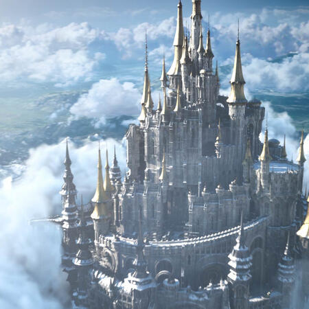
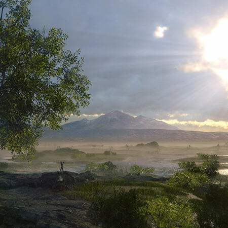
The world's largest continent based on land area and occupies nearly two-thirds of the La Renne-Cygalatia landmass. The Great Frontier Mountain Range acts as a natural border that locks the continent just south of La Renne. The continent is surrounded by the Rionad Sea to the west, the Ciarr Sea to the east, and the Adalatian Strait and Socin Sea to the south.The continent has a diverse climate and biome, with a wide desert plain in its center, temperate zones in its west and southeast, and a tropical southwest. Its most defining feature, however, is the remnants of a nine-million year-old asteroid crater, leaving a permanent circular shape on its western gulf. It has also a comprehensive and very busy railway system that connects all cities in West and South Cygalatia, as well as to the capital of Central Cygalatia. The busyness of Cygalatia's transport system is owed much to its dynamic mercantile culture and metropolitan lifestyle.South Cygalatia is the main governing region of Cygalatia with the continent's main capital found just at the foot of the Ickann Mountains. The region is lush and abundant with green space, notable for the Genety Forest creeping into West Cygalatia, and the fertile subtropic Meek Lands on its eastern side, opening up to the Ciarr Sea. The Eun Ho River serves as a natural border that separates the region from the west.West Cygalatia is the economic hub of the continent, with a rich coastline opening up to the Rionad Sea. It is a dynamic port region that sustains and controls trans-Rionad shipping routes into Cygalatia, making the region the most important coast in global sea trade. A minor mountain range is found south of Tierra's iconic Impact Crater, further isolating the rich trading industry within the region. The southern gulf is also the continent's only tropics whose forests connect with the Genety Forest. The Kovu River, Tierra's longest river, is found east of the region and also serves as a natural boundary separating itself from Central Cygalatia.East Cygalatia, also known as Ciarnesia, consists of a group of islands called the Fortress Islands. The islands are rightly named so as they form a natural shield for Cygalatia facing the western coast of Carcause in the Ciarr Sea. Each smaller polity in Ciarnesia functions independently and autonomously from each other.
Central Cygalatia is the inner heartland of Cygalatia and is a dry desert land surrounded by the Ickann Mountains to the east and the Great Frontier Mountain Range to the north. The Sigall Desert is mostly dry whole year round, with Lake Miki filling up and flooding nearby waterways during the wet season. The valley found at the foot of Mt. Hierus, north of the desert, provides a narrow passageway into La Renne. The Khitna Valley opens up Central Cygalatia's northeast into the Drakon Cove and an alternative route into La Renne through the Ventus Pass.The three main polities of Cygalatia are the Gyeuos Kingdom, Szarine Nation, and the Roc Emirate, all governing South, West, and Central Cygalatia respectively. The continental capital, Hangeum Capital City (seen in the photo above), is the largest city on Tierra, and is also the central seat of power of the Gyeuos Kingdom. Also in Hangeum is the Castle of the Council of Masters, the seat of governance of all guilds and mercenaries. Below are the scope of each polity in Cygalatia:GYEUOS KINGDOM
Capital : Hangeum Capital City
Metropolitan/s : Sibjaa City
Major Polity/ies : Joge Port City, Weiming City
Towns & Municipalities : Fei Le Town, Miyang Port
Important Locations : Castle of the Council of Masters (Hangeum), CRS Grand Station (Sibjaa), Energy Farm (Meek Lands), Hangeum Cathedral (Hangeum), Hangeum Hangar (Hangeum), Helix Space Hangar (Meek Lands), Royal Knights Academy (Hangeum), Zhong Ruins (Genety Forest)
Dungeons : Santuario de Dios, Zhong DungeonSZARINE NATION
Capital : Alaminos City
Metropolitan/s : Qing Feng City
Major Polity/ies : Le Troi City
Towns & Municipalities : Chrux Town, Magna Town
Important Locations : Le Troi Beach (Le Troi), Magician's Court (Alaminos), Qing Feng Central Port (Qing Feng)
Dungeons : Alaminos Tower, Cygalatia Tower, Robotics Lab, Toy FactoryROC EMIRATE
Capital : Roc Capitol (seen in the photo below)
Metropolitan/s : Khitna Citadel
Towns & Municipalities : Devarnas Town, Sigall Checkpoint
Important Locations : Kohmit Temple (Roc Capitol), Lake Miki (Sigall Desert), The Oasis (Sigall Desert), Vahkan Temple (Khitna)
Dungeons : Khitna Underground Sewer, Drakon Cove, Pyramids, Ventus Pass, Wasp NestCIARNESIA
Towns & Municipalities : Durha Town, Radoko Town, Yunnu Town
Important Locations : Locket Lake
Dungeons : Locket Island< M E N U >
HALVESTATT
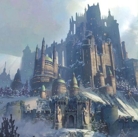
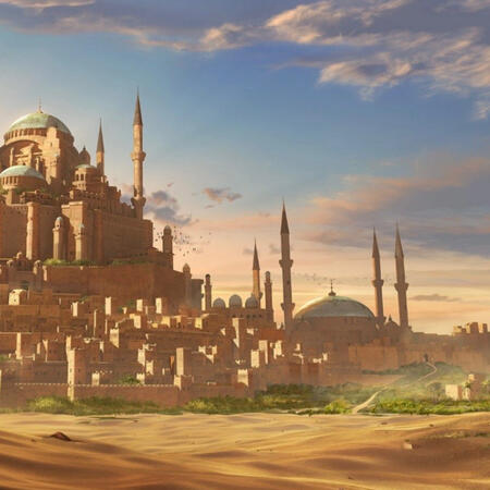
The most mountainous continent in the world, Halvestatt is a cooler northern continent that has dramatic fjords, and rugged mountains that fill most of the continent's land area. Despite its mountainous landscape, its plateaus and lowlands are still habitable with a specific culture that works around its difficult topography. The continent is split between Mainland Halvestatt and the Poljesk Island, with the mainland having temperate to subarctic and alpine conditions and Poljesk Island having a nearly arctic climate.Its highlands and lowlands below the foot of the Nilvest and Ulvee Mountain Ranges consists of only one-fourth of the mainland, facing the Tuaisdh Sea to the southeast. The Ulvee Range in the west blocks any passageway to and from the Ciarr Sea, and the Nilvest Range in the north blocks any passageway to and from the Halghie Sea. The south and southeast coastlines open up the continent to sea travel, especially to the Poljesk Island. Which is largely uninhabitable.West Halvestatt consists of the boundaries of the Ulvee Range, with a temperate southern portion, slowly transitioning into colder then freezing climate going north. The south is also the only land passageway into Halvestatt. One must take the very narrow land bridge called the Serpent's pass from Carcause in order to get into the continent. The IRC terminal station is located in Mobeau City, pushing commuters to take smaller commute options (such as boats) or walking in the Halvez Woodlands, pass through the Halvestatt Gateway, and cross the Serpent's Pass in order to reach Carcause.North Halvestatt consists of the boundaries of the snowy and freezing Nilvest Range, with a valley in the middle called the Vyzik Tundra. The cold climate is harsh here, leaving this area almost completely uninhabitable. The Vyzik Tundra is also largely empty, filled with glaciers, frozen rivers, and underground and under-the-ice waterways. This also allows the presence of fjords in the southern (especially southeast) portion, where the Nilvest meets the temperate southeast region.
Southeast Halvestatt is the region where almost all of the continent's population lives in. Its southern portion are its lowlands, with the plateaus and highlands present as elevation rises going into the center of the continent, towards Mr. Ordono where the Nilvest and Ulvee meet, and towards the foot of the Nilvest. The eastern portion of the region has many fjords as waterways exit into the ocean. Just south of the fjords one can find the Zilts Bay, the main port coast of the continent as it also welcomes ships from La Renne and Cygalatia. The continent's capital is also located near the bay, placing it in a strategic location for the continent economics. Halvestatt has no plains, but it still has relatively open spaces in its center, which is included in this region.East Halvestatt consists of the Poljesk Island and its smaller surrounding islands. It is largely uninhabited due to its harsh cold climate and having the world's largest volcano. Mt. Stavos is a stratovolcano and is long overdue for an eruption, making it the most dangerous volcano on Tierra. There is only one major town on Poljesk Island that serves as a port city for fishing, and transit of goods especially to La Renne.There is only one paramout polity on Halvestatt, the Cadnerth Empire, governing the entire continent. The continental capital, Drajkic Capitol (seen in the photo above) is the central seat of power of the Cadnarth Empire. Despite the empire ruling over the entire territory, the regions covered by its two mountain ranges remain autonomous with any town or polity operating on its own, but also gets the economic support of the empire.CADNERTH EMPIRE
Capital : Drajkic Capitol
Metropolitan/s : Zilts City
Major Polity/ies : Mobeau City, Rokov Port City (Poljesk Island; seen in the photo below)
Towns & Municipalities : Bychtil Town (Poljesk Island), Huon Gakh Town, Loede Town, Yuzch Checkpoint (Poljesk Island)
Important Locations : Grand South Fjord, Mystic Forest (Halvaz Woodlands)
Dungeons : Ancient Ruins, Cursed Monastery, Drajkic Bell Tower, Halvestatt GatewayHALVESTATT AUTONOMOUS REGION
Towns & Municipalities : Aurce Village (Ulvee Range), Dil Zatt Village (Vyzik Tundra), Juzinn Town (Vyzik Tundra)
Important Locations : Lake Tume (Vyzik Tundra), Vyzik Center (Vyzik Tundra)
Dungeons : Mt. Ordono< M E N U >
LA RENNE
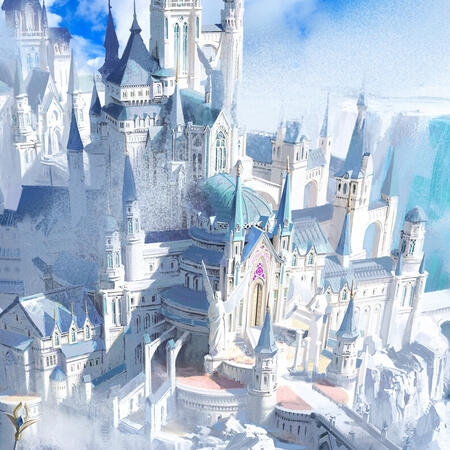
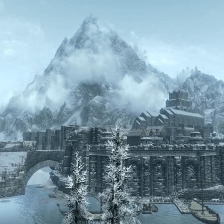
The world's largest open space. La Renne is often mistaken as the most mountainous continent on Tierra, and rightfully so as it has the longest mountain range in the world, as well as the highest elevation in the world. However, it is because of the continent's high latitude and the high elevation that most of the continent is covered in ice with the harshest climate on Tierra. This gives an impression that most of the inaccessible areas are high mountains, but La Renne has wide, open spaces, albeit frozen, that serve as important passageways for the continent's great freshwater systems and reserves.Since the continent is subarctic and arctic, its land is covered in snow and ice. However, La Renne also boasts Tierra's most abundant freshwater source. Water coming from the surrounding mountains all flow down into the Muihan Waterways, La Renne's freshwater system. Most flor through the Graviga Tundra, which is a highland with varied elevations from rolling hills, plateaus, and narrow valleys where rivers flow through. However, it is also because of this system that the cold interior is also largely inhabited due to high risk of flooding and avalanches.North La Renne covers the entire territory spanning the White Crown Mountain Range, both Mt. Cirele and Mt. Boreas in the west, and the glacier-filled Graviga Tundra in the continent's center. It is completely uninhabited withour any local communities due to its harsh arctic climate and difficult topography. Mt. Cirele and Mt. Boreas are twin volcanoes, however, Cirele is extinct, while Boreas is active, decreasing any possible warming in the continent. The long mountain range also blocks the south of the continent from accessing the Halghie Sea in the north.Southeast La Renne is a region of diverse conditions; the ice-covered Somur Valley in the east providing semi-liveable conditions, the continent's capital in the west beside the calmer lowlands, the world's highest peak, Mt. Ventus (seen in the photo on the right), in the south, transitioning down into temperate woods opening to the Ciarr Sea, and a colder, glacier-filled corridor in the north, right at the foot of the White Crown. Mt. Ventus is also the easternmost peak of the Great Frontier Mountain Range, forming as the southern physical separation from Cygalatia in the south. Mt. Hierus and the narrow valley in the middle of the mountain range also serves as one of the main passageways in and out of La Renne.
Southwest La Renne is the continent's lowest elevation, called the La Renne Lowlands. It is also the continent's economic hub, with the continent's major cities are located at the western coast facing the Tuaisdh Sea, opening La Renne to world economic trade routes. The calmer river system in the La Renne Lowland also allows communities to settle there to manage the livestock and agricultural farms of the continent. Its western edge has also only recently flourished due to the rise of tourism in the area, making the region's capital the most modern metropolitan in the world.There is only one paramout polity on Halvestatt, the La Renne Empire, the longest-ruling dynasty on Tierra which the entire continent is named after. The continental capital, La Renne Center Capitol (seen in the photo above) is the central seat of power of the dynastic empire. Northern La Renne is also under the political control of the empire despite it being uninhabited, with the empire having ancestral claims on the mountains. Southwest La Renne, called the Republic of La Renne, is also a semi-autonomous region to allow them to flourish and grow on its own terms since the Center Capitol is located very far from it. The republic, however, is still under the official control of the La Renne Empire.LA RENNE EMPIRE
Capital : La Renne Center Capital
Towns & Municipalities : Balkrr Village, Huksye Town
Important Locations : Lagharr Monastery (Mt. Ventus), Somur Valley
Dungeons : La Renne Castle Dungeon, Somur TowerREPUBLIC OF LA RENNE
Capital : Baltisse Grand City
Major Polity/ies : Ying'gi City
Towns & Municipalities : Czakch Town (La Renne Lowland), Lowland Checkpoint (La Renne Lowland), Malborh Town (La Renne Lowland), Nottire Port
Important Locations : Frost Bite Academe (La Renne Lowland)
Dungeons : Fort Malborh, Mt. HierusNORTHERN AUTONOMOUS REGION
Important Locations : Lake Mogherty (Graviga Tundra), Lake Sazin (Graviga Tundra), Mt. Cirele, Mt. Boreas, Muihan Basin (Graviga Tundra), Muihan Waterways (Graviga Tundra)
Dungeons : Boreas Volcano, Heaven's Gate (White Crown Cave), White Crown Cave< M E N U >